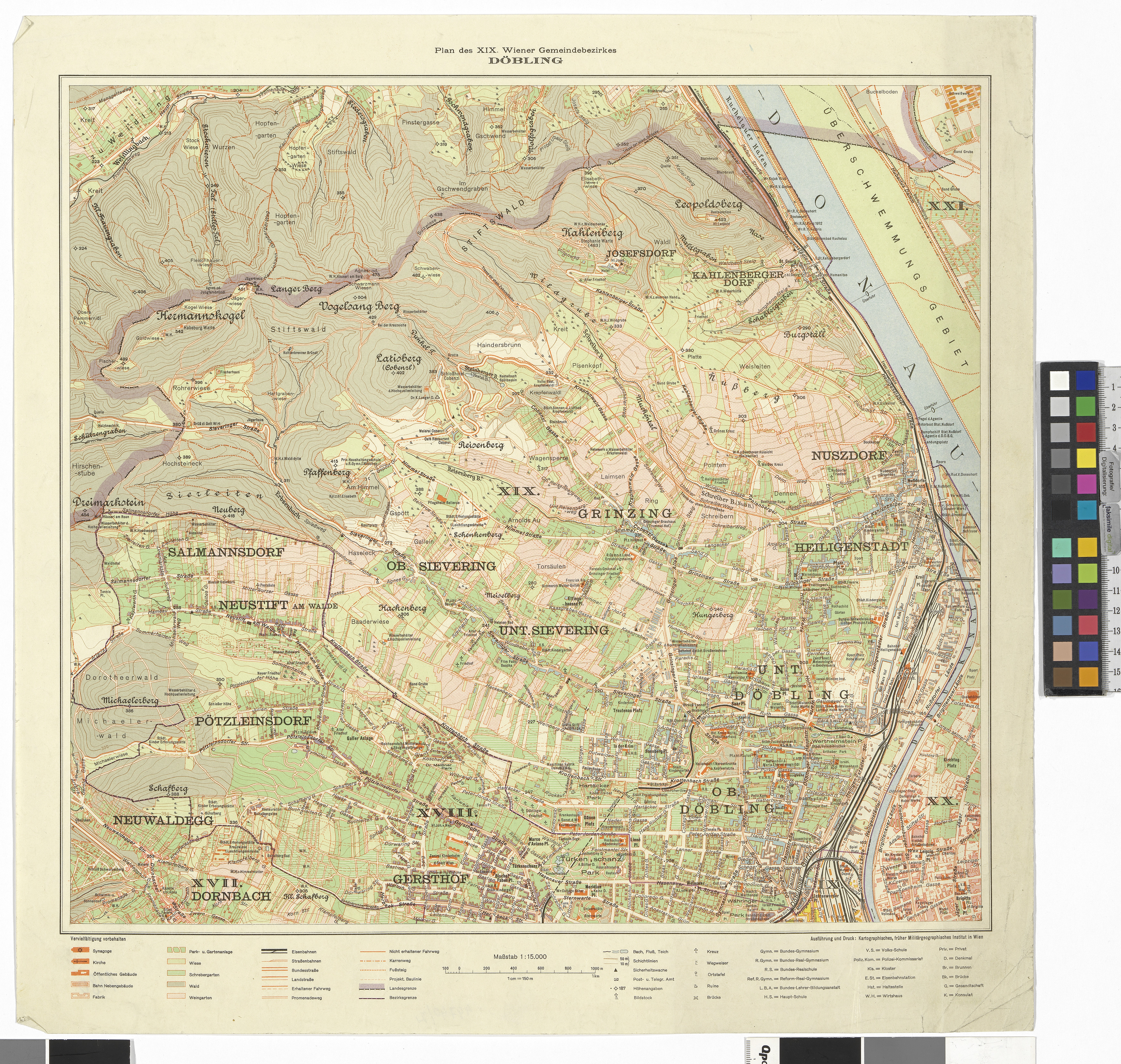
19., Plan des Bezirks Döbling
- Artists/Producer
Name Role Kartographisches (früher Militärgeographisches) Institut in Wien realisation- Inventory number
- 49740/2
- Classification
- Date
- 1928
- Material
- Technique
- Dimensions
- Bildmaß 42×46 cm
- Blattmaß 50×50 cm
- Maßstab 1:15.000
- Themes
- Subjects
- Iconclass Codes
Have you found a possible mistake or have additional information about this object?
We look forward to hearing from you at:
onlinesammlung@wienmuseum.at