Plastische Darstellung des Terrains der inneren k.k. Haupt- und Residenzstadt Wien samt den Glacisgründen nach der Aufnahme und dem Nivellement des...
(Original title)- Descriptive title
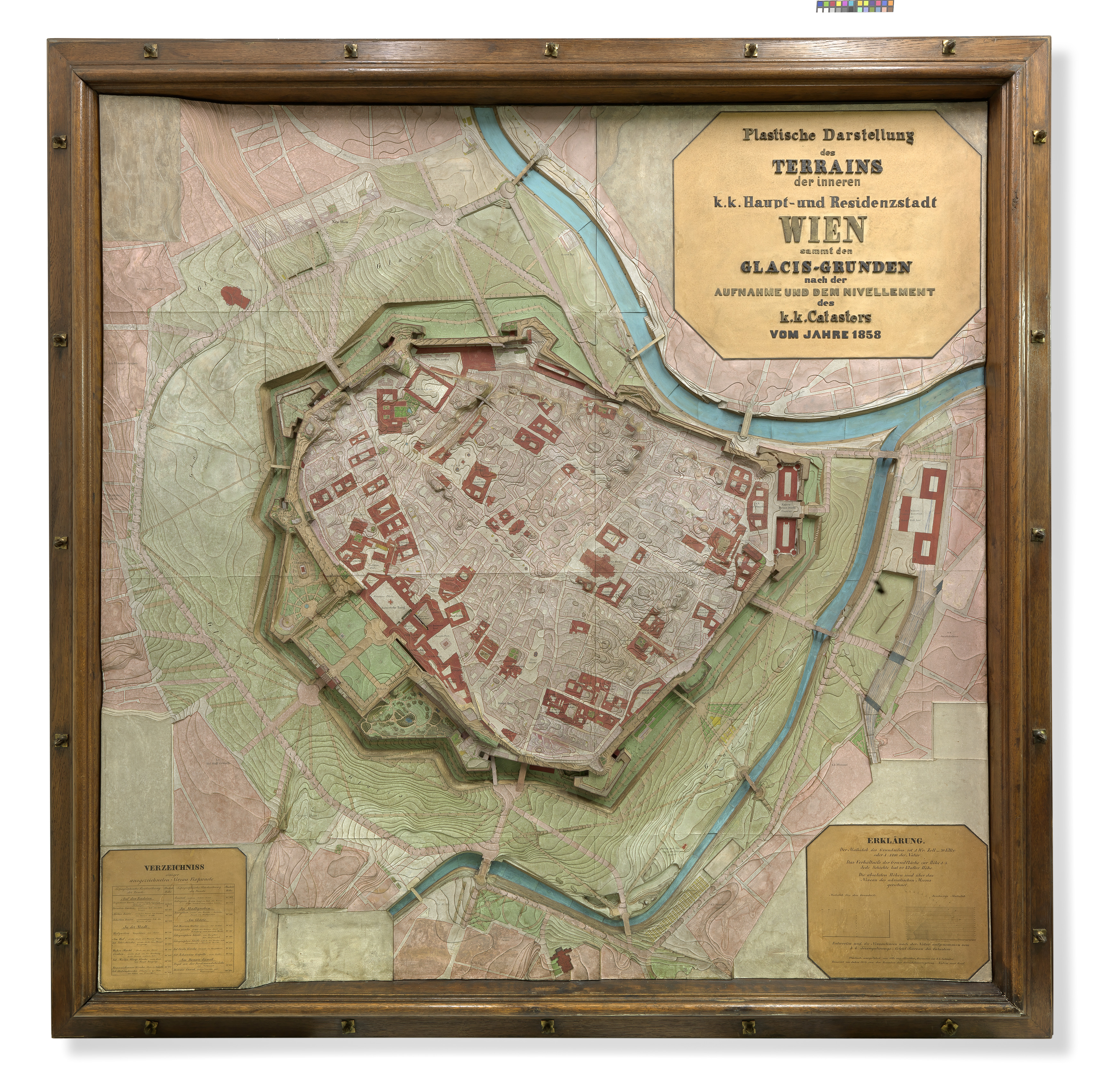
- Plastische Darstellung (Reliefplan bzw. Schichtenmodell) des Terrains der inneren Stadt von Wien nach dem Kataster von 1858
- Artists/Producer
Name Role Otto von Altvatter Artist- Inventory number
- 31020
- Classification
- Date
- 1858
- Material
- Dimensions
- Höhe 174 cm
- Breite 174 cm
- Rahmenmass 206×206 cm
- Literature
- Das ungebaute Wien 1800 bis 2000, Hauptautor: Wilhelm Holzbauer, Renata Kassal-Mikula et al., 1999, S. 53, Abb. S. 53
- Alt-Wien. Die Stadt die niemals war, Hauptautor: Hrsg von Wolfgang Kos und Christian Rapp, 2004, S. 371
- Das Stadtbild Wiens im 19. Jahrhundert. Von der Festung zur Großstadt, Hauptautor: Alfred May, 1960, S. 30, Abb. S. Abb. 1
- Der Ring Pionierjahre einer Prachtstraße, 2015, S. 104, Abb. S. 104
- Inscription
- Otto von Altvatter, Geometer im k.k. Cataster, 1858
- Themes
- Subjects
- Iconclass Codes
Have you found a possible mistake or have additional information about this object?
We look forward to hearing from you at:
onlinesammlung@wienmuseum.at