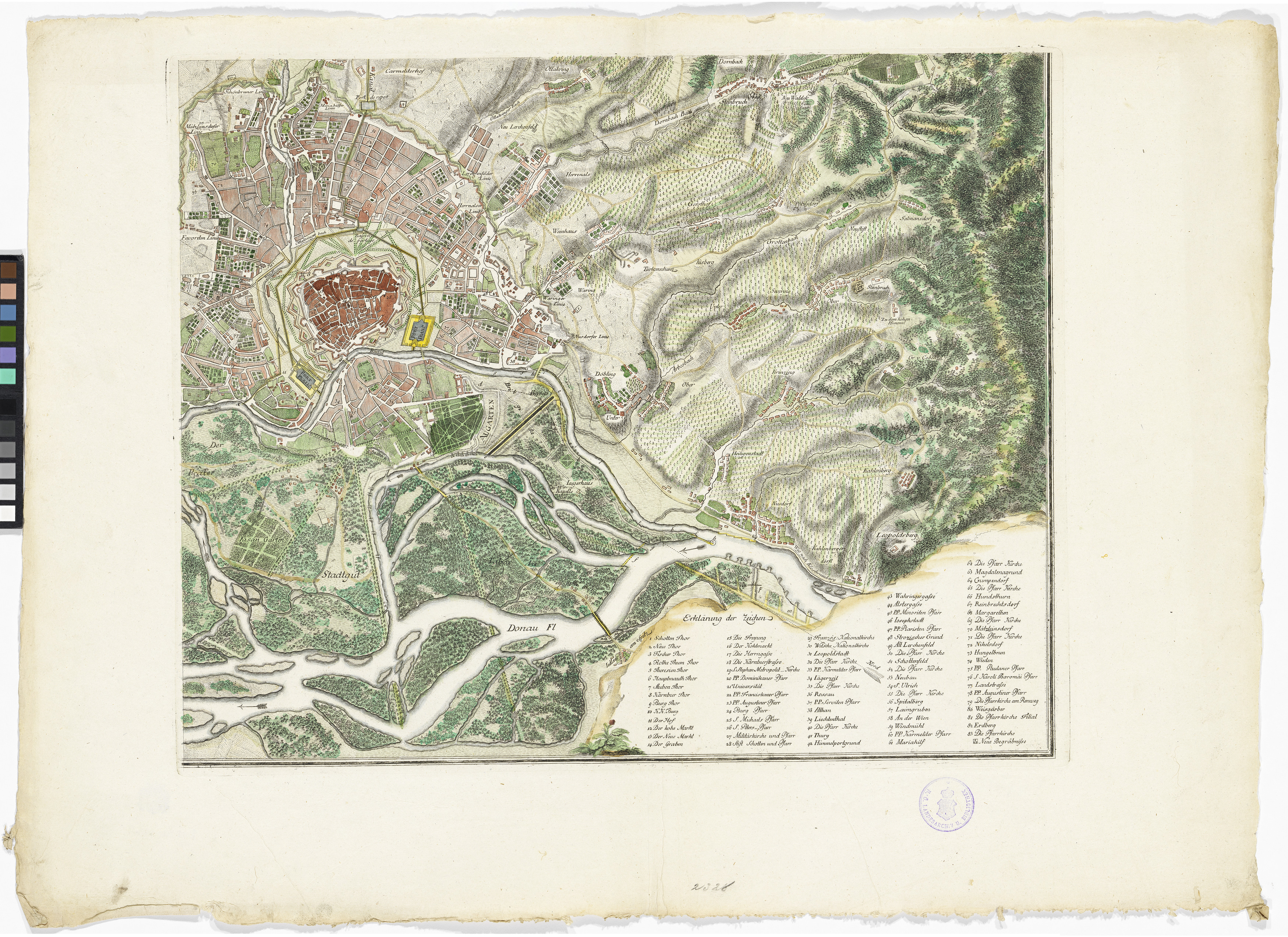
"Topohydrographische Karte der Stadt Wien und ihren umliegenden Gegenden [...] seinem Canal von Burkersdorf zum freyen Hafen." (4-Teiliger Plan, Blattschnitt rechts unten)
- Artists/Producer
Name Role Francois Joseph Maire (1738—1788) cartographer- Inventory number
- 45757/2
- Classification
- Date
- 1788
- Material
- Technique
- Dimensions
- Maßstab: ca. 1:25.000
- Höhe×Breite 19,8×27 cm (Nebenkarte)
- Plattenmaß 43,4×53,6 cm
- Blattmaß 53,5×74,7 cm
- Themes
- Subjects
- Iconclass Codes
- External Links
Have you found a possible mistake or have additional information about this object?
We look forward to hearing from you at:
onlinesammlung@wienmuseum.at