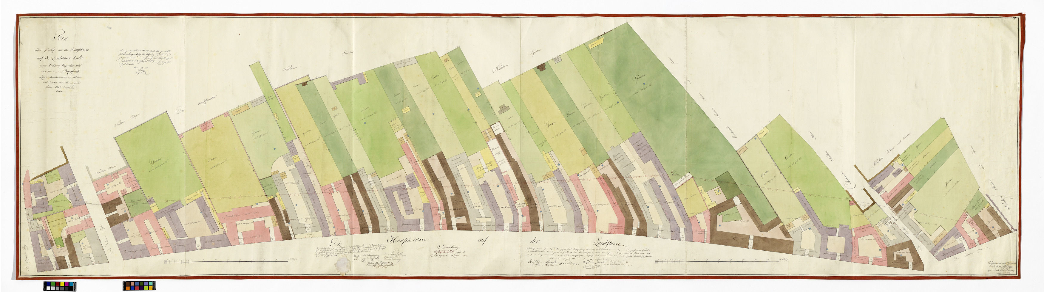
Plan über sämtliche an der Hauptstraße auf der Landstraße links gegen Erdberg liegenden und von der agnoscirten Burgfrieds. Linie durchschnittenen Häuser und Gärten wie selbe in dem Jahre 1818 bestanden haben.
(Original title)- Title
- 3., Situationsplan der Häuser der östlichen Seite der Landstraßer Hauptstraße mit Burgfriedlinie (von Anton Behsel)
- Color
- #d4c228
- #fee6c7
- #795025
- #82b872
- #fba86c
- #68ab59
- Artists/Producer
Name Role Anton Behsel (1781—1838) cartographer- Inventory number
- 45697
- Classification
- Date
- 1818
- Material
- Technique
- Dimensions
- Blattmaß 88×330 cm
- Maßstab: ca. 1:230
- Themes
- Subjects
- Iconclass Codes
- External Links
Have you found a possible mistake or have additional information about this object?
We look forward to hearing from you at:
onlinesammlung@wienmuseum.at