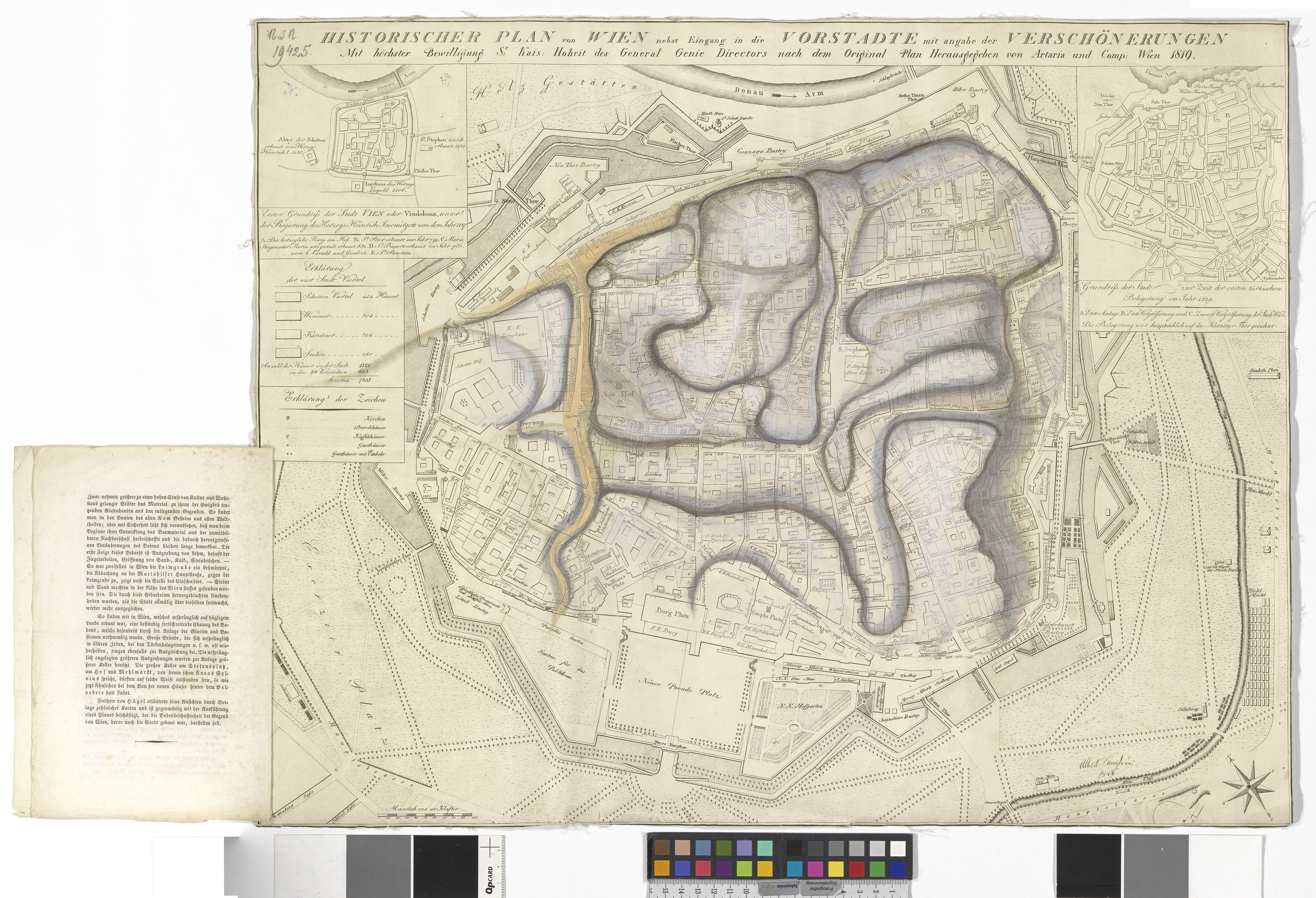
Historischer Plan der Stadt Wien (1819) mit Eintragungen der Terrainveränderungen durch Albert Camesina (1846)
- Artists/Producer
Name Role Artaria & Co. Verlag publishing houseAlbert von Camesina (1806—1881) cartographer- Inventory number
- 19425
- Classification
- Date
- 1819 (print)
- 1846 (Application)
- Material
- Technique
- Dimensions
- Blattmaß 50×64 cm
- Maßstab: ca. 1:3.000
- Themes
- Subjects
- Iconclass Codes
- External Links
Have you found a possible mistake or have additional information about this object?
We look forward to hearing from you at:
onlinesammlung@wienmuseum.at