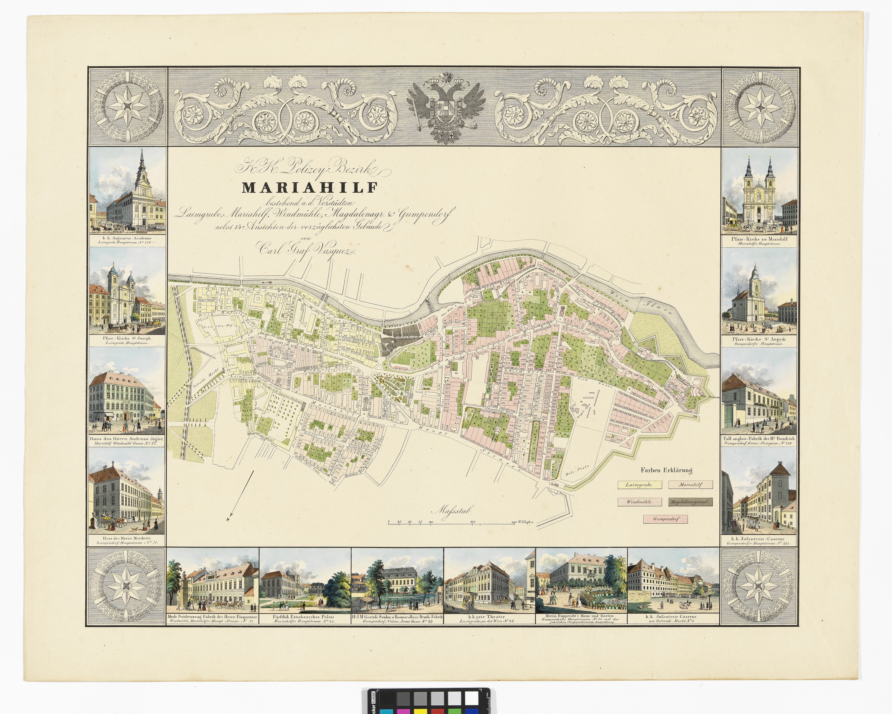
"K.K. Polizey Bezirk Mariahilf: bestehend a. d. Vorstädten Laimgrube, Mariahilf, Windmühle, Magdalenagr. & Gumpendorf nebst 14 Ansichten der vorzüglichsten Gebäude"
(Original title)- Descriptive title
- 6., Pläne mit Ansichten der Stadt Wien (Mariahilf), mit 14 Randveduten
- Artists/Producer
Name Role Carl Graf Vasquez (1798—1861) cartographer- Inventory number
- 105971/6
- Classification
- Date
- around 1835
- Material
- Technique
- Dimensions
- Maßstab: ca. 1:5.800
- Bildmaß 35×48,7 cm
- Blattmaß 58,7×73,4 cm
- Plattenmaß 49,2×62,7 cm
- Info/Text
- Randveduten v. links oben nach rechts oben (gegen Uhrzeigersinn):
1.) k.k. Ingineur Akademie
2.) Pfarre St. Josef ob der Laimgrube
3.) Haus v. Andreas Jäger (Ecke Mariahilferstraße/Windmühlgasse)
4.) Marchettihaus
5.) Mode- und Seidenzeugfabrik des Hr. Fürgantner (Mariahilferstraße Nr. 71)
6.) Palais Esterhazy
7.) J.M. Gratzl Seiden- u. Baumwolldruckfabrik
8.) Theater an der Wien
9.) Rupprechtsgarten
10.) k.k. Infanterie Kaserne (Getreidemarkt)
11.) Gumpendorfer Kaserne
12.) “Tull-Anglais-” Fabrik v. Damböck
13.) Gumpendorfer Kirche (St. Aegydi)
14.) Mariahilfer Kirche (Barnabitenkirche) - Literature
- Johann Strauß. Unter Donner und Blitz, Hauptautor: Otto Brusatti, Günter Düriegl, Regina Karner et al., 1999, S. 320, Kat.-Nr. II/3
- Das Stadtbild Wiens im 19. Jahrhundert. Von der Festung zur Großstadt, Hauptautor: Alfred May, 1960, S. 11,13, Kat.-Nr. 14
- Themes
- Subjects
- Iconclass Codes
- External Links
Have you found a possible mistake or have additional information about this object?
We look forward to hearing from you at:
onlinesammlung@wienmuseum.at