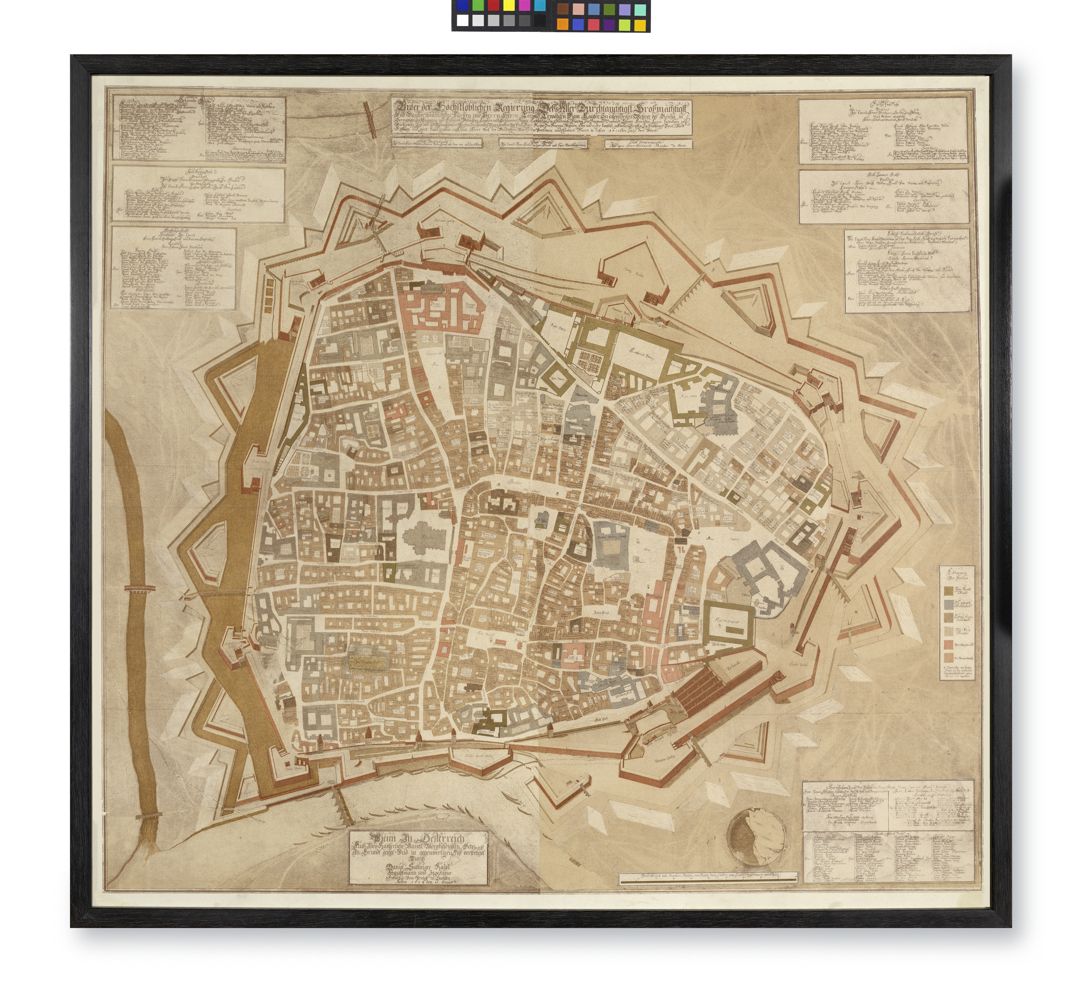
Plan der Stadt Wien, 1684 (verkleinerte Reproduktion, aus: Eisler, Hist. Atlas des Wiener Stadtbildes, 1919, Tafel X und XI, ohne Blattrand)
- Artists/Producer
Name Role Daniel Suttinger (1640—1690) cartographerMax Eisler (1881—1937) editor- Inventory number
- 72200
- Classification
- Date
- 1919 (reproduction)
- Material
- Technique
- Dimensions
- Höhe 72 cm
- Breite 82 cm
- Rahmenmaß 81,5×87,5×2 cm
- Themes
- Subjects
- Iconclass Codes
- External Links
Have you found a possible mistake or have additional information about this object?
We look forward to hearing from you at:
onlinesammlung@wienmuseum.at