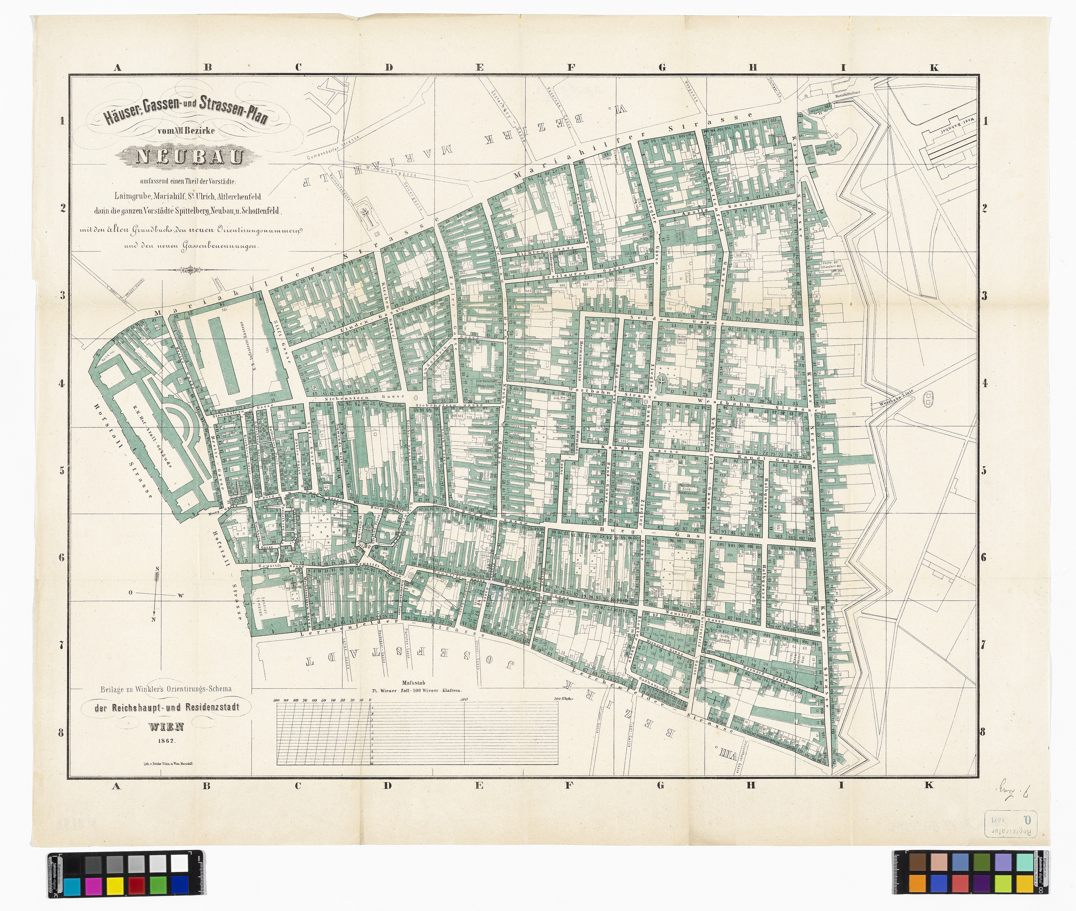
"Häuser, Gassen- und Straßen-Plan vom VII. Bezirke Neubau umfassend einen Teil der Vorstädte: Laimgrube, Mariahilf, St. Ulrich, Altlerchenfeld darin die ganzen Vorstädte Spittelberg, Neubau u. Schottenfeld mit den alten Grundbuchs, den neuen Orientirungsnummern und den neuen Gassenbenennungen."
(Original title)- Descriptive title
- 7., Plan des Bezirks Neubau (Beilage zu Winklers Orientierungsschema)
- Artists/Producer
Name Role Brüder Böhm Printer- Inventory number
- 38948/9
- Classification
- Date
- 1862
- Material
- Technique
- Dimensions
- Blattmaß 57,9×70,9 cm
- Bildmaß 49,1×63,6 cm
- Maßstab: ca. 1:3.000
- Themes
- Subjects
- Iconclass Codes
- External Links
Have you found a possible mistake or have additional information about this object?
We look forward to hearing from you at:
onlinesammlung@wienmuseum.at