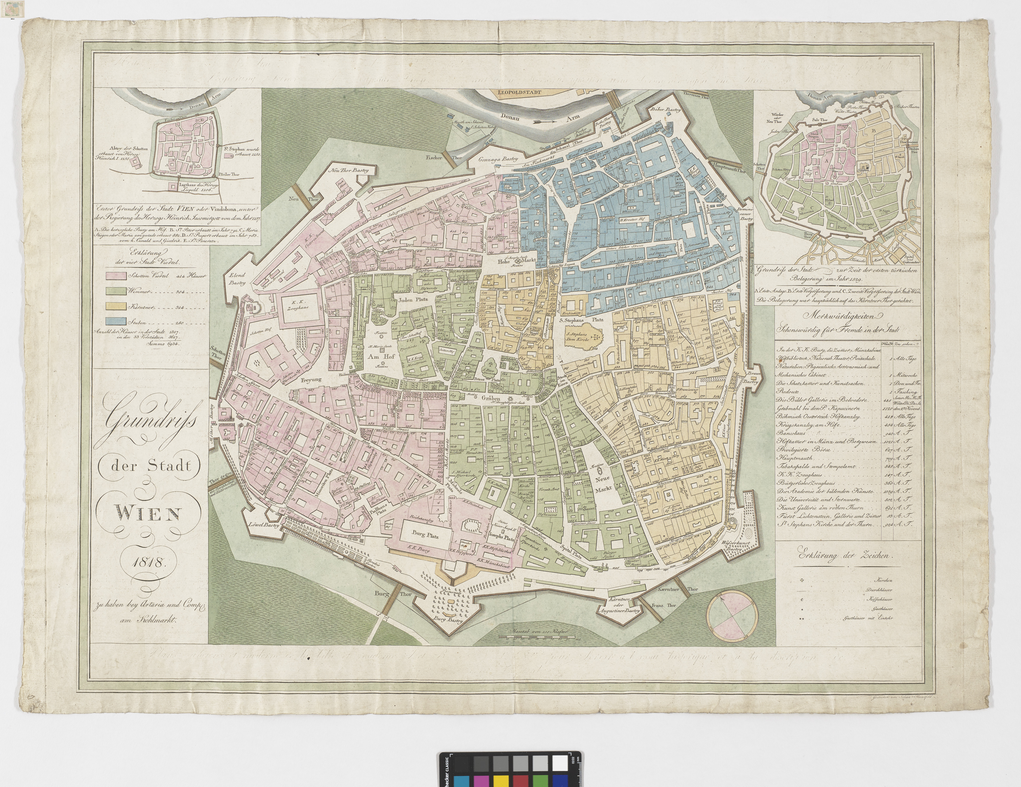
"Grundriss der Stadt WIEN 1818."
(Original title)- Descriptive title
- Plan von Wien mit 2 Nebenkarten (Wien zur Zeit v. Heinrich Jasomirgott, 1157 und Wien zur Zeit der ersten Türkenbelagerung 1529)
- Artists/Producer
Name Role Artaria & Co. Verlag publishing houseJohann Georg Mansfeld (1764—1817) engraver- Inventory number
- 238980/103
- Classification
- Date
- 1818
- Material
- Technique
- Dimensions
- Blattmaß: ca. 52,7×73,5 cm
- Maßstab: ca. 1:3.270
- Bildmaß: ca. 42,2×43,2 cm
- Info/Text
- 2 Nebenkarten, links oben: Wien zur Zeit von Heinrich Jasomirgott, 1157; rechts oben: Plan von Wien zur Zeit der ersten Türkenbelagerung im Jahr 1529
- Themes
- Subjects
- Iconclass Codes
- External Links
Have you found a possible mistake or have additional information about this object?
We look forward to hearing from you at:
onlinesammlung@wienmuseum.at