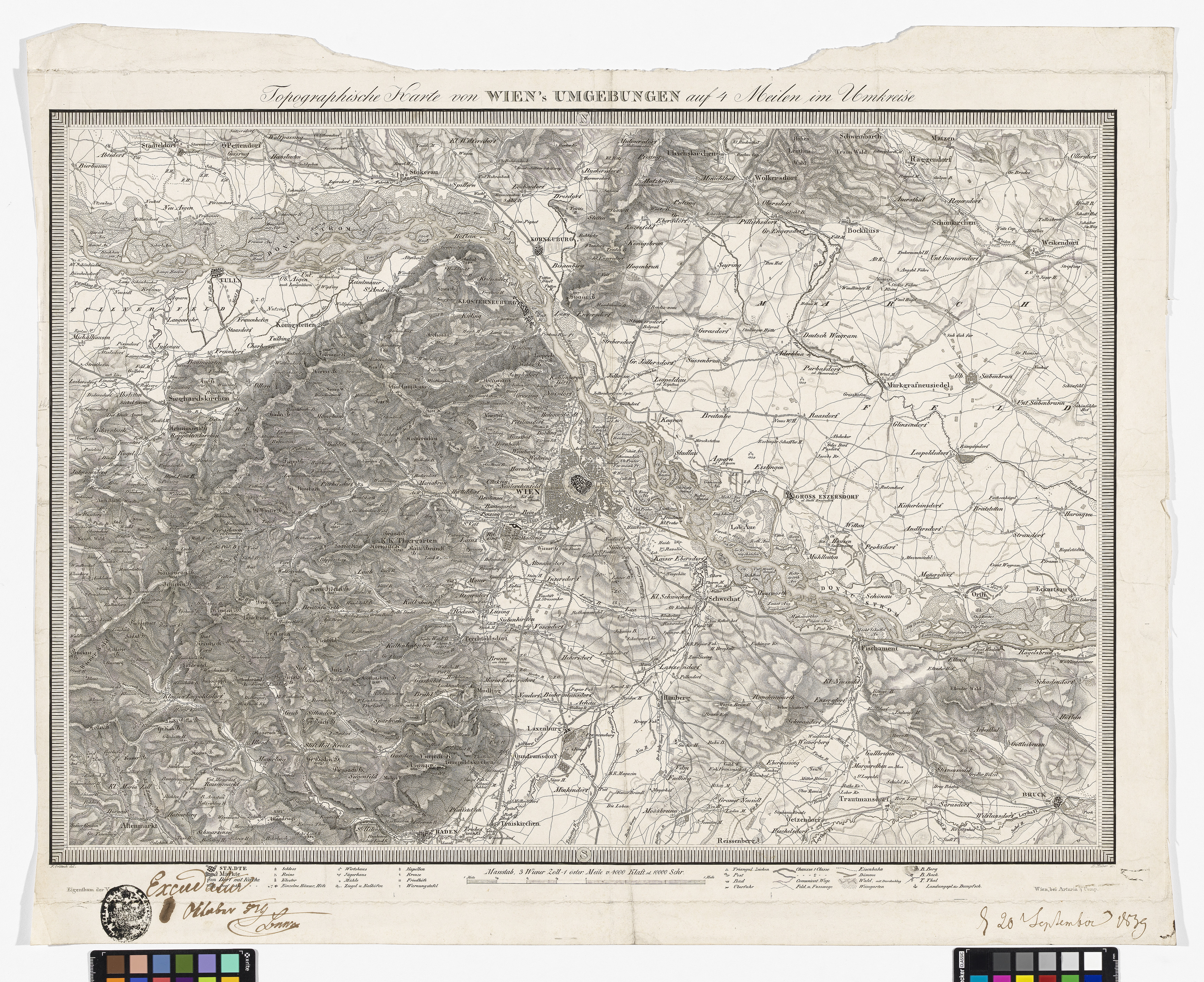
"Topographische Karte von Wien´s Umgebungen auf 4 Meilen im Umkreise", (mit Zensurvermerk)
- Artists/Producer
Name Role Franz Orlitsek cartographerD. Huber engraverArtaria & Co. Verlag publishing house- Inventory number
- 238980/74/4
- Classification
- Date
- 1839
- Material
- Technique
- Dimensions
- Blattmaß: ca. 60,3×74,5 cm
- Bildmaß: ca. 47×67,4 cm
- Maßstab: ca. 1:150.000
- Themes
- Subjects
- Iconclass Codes
Have you found a possible mistake or have additional information about this object?
We look forward to hearing from you at:
onlinesammlung@wienmuseum.at