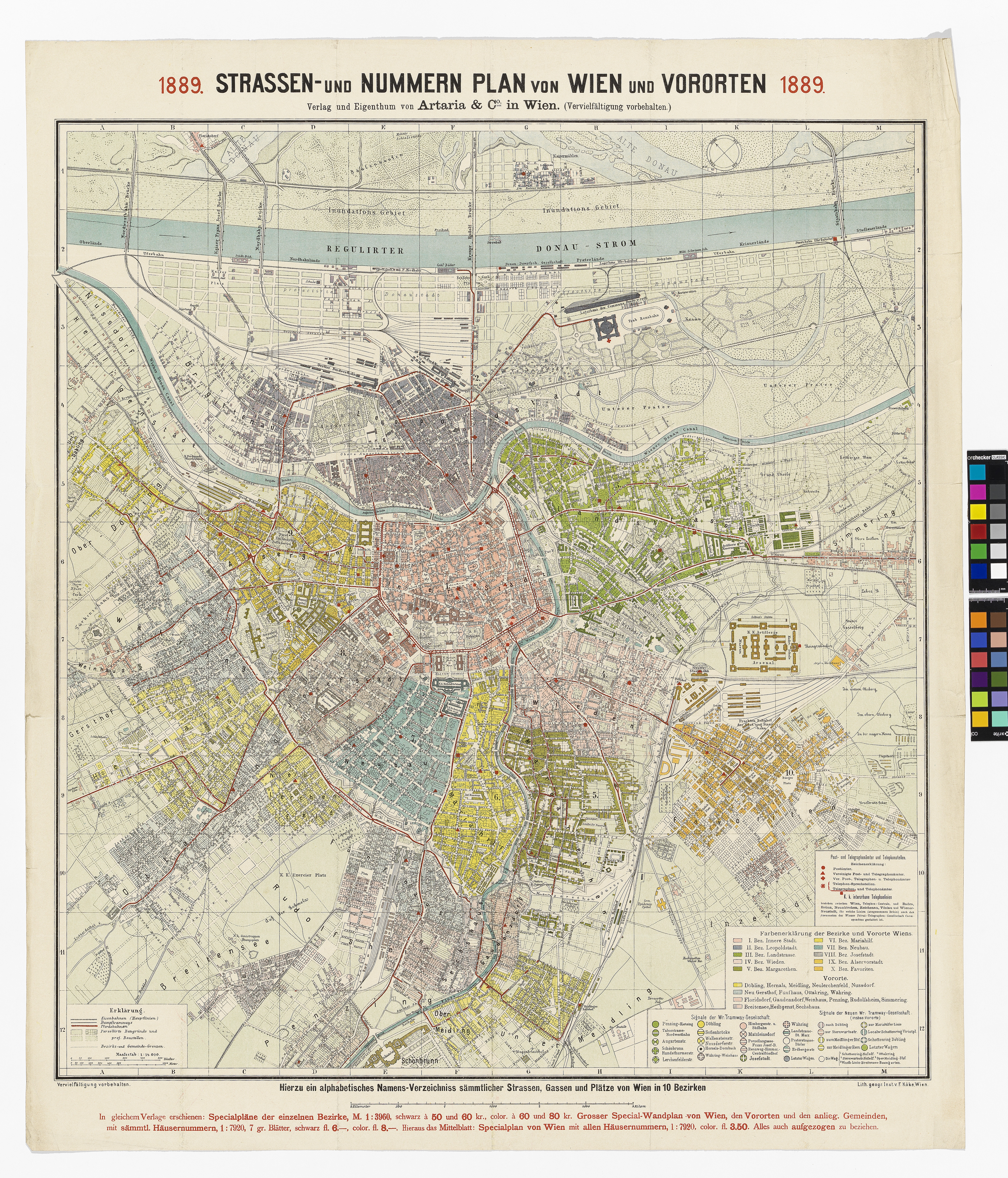
"Strassen- und Nummern Plan von Wien und Vororten 1889."
(Original title)- Descriptive title
- Stadtplan von Wien und Vororten mit Straßennummern, Farbeinteilung der Bezirke, Tramwaysignalen, Post- und Telegraphenämtern und Telephonstellen
- Artists/Producer
Name Role F. Köke printing pressArtaria & Co. Verlag publishing house- Inventory number
- 238980/84/9
- Classification
- Date
- 1889
- Material
- Technique
- Dimensions
- Maßstab: ca. 1:14.000
- Blattmaß: ca. 84×71 cm
- Bildmaß: ca. 71×64,6 cm
- Themes
- Subjects
- Iconclass Codes
- External Links
Have you found a possible mistake or have additional information about this object?
We look forward to hearing from you at:
onlinesammlung@wienmuseum.at