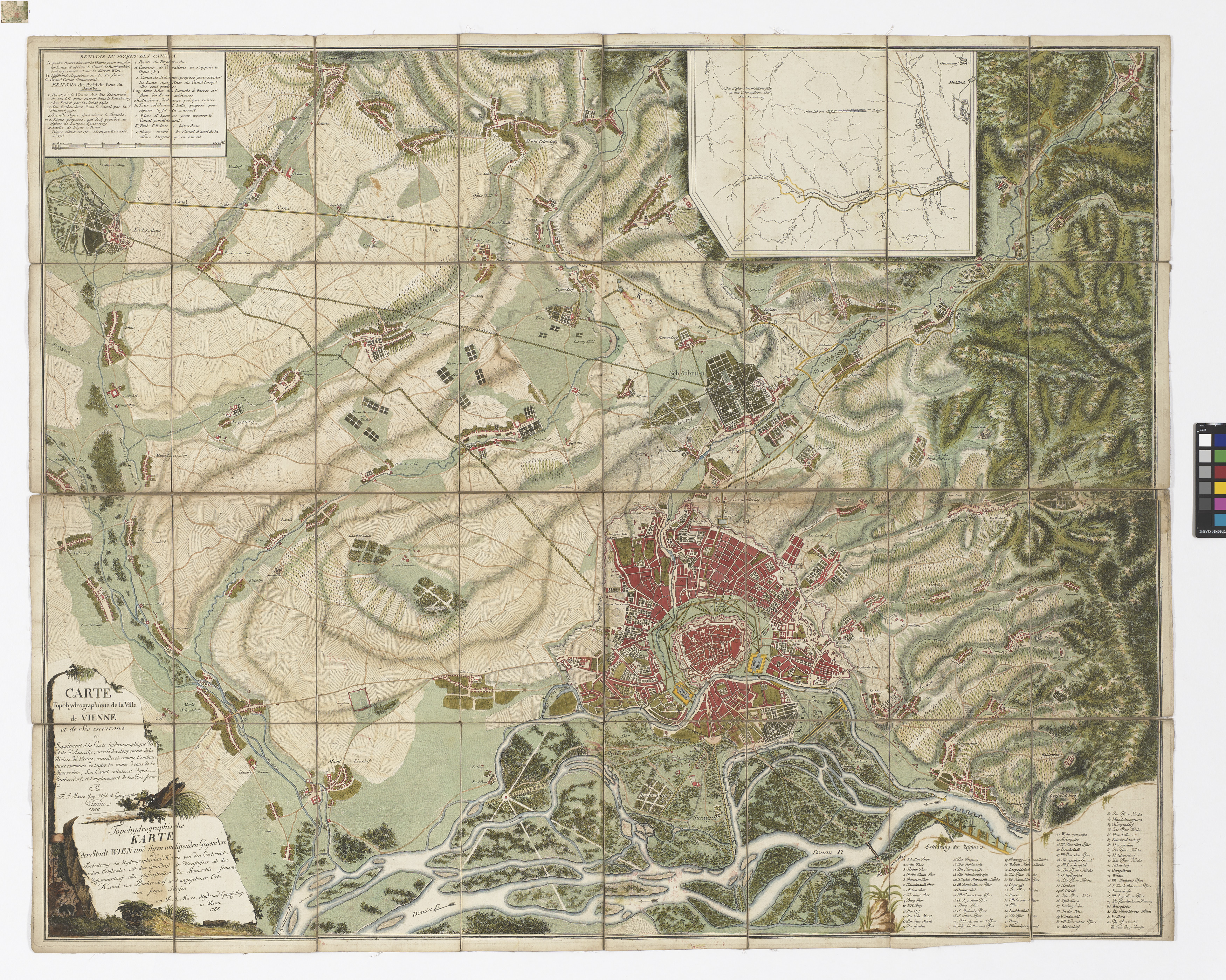
"Topohydrographische Karte der Stadt Wien und ihren umliegenden Gegenden [...] seinem Canal von Burkersdorf zum freyen Hafen."
- Artists/Producer
Name Role Francois Joseph Maire (1738—1788) cartographer- Inventory number
- 239203
- Classification
- Date
- 1788
- Material
- Technique
- Dimensions
- Blattmaß: ca. 86×107,5 cm
- Bildmaß: ca. 83×104,5 cm (Hauptkarte)
- Bildmaß: ca. 20×27 cm (Nebenkarte)
- Maßstab: ca. 1:25.000
- Inscription
- “Topohydrographische/KARTE/der Stadt WIEN und ihren umligenden Gegenden/oder/Fortsetzung der Hydrographischen Karte von den Oesterreich=/ischen Erbstaaten mit dem Grundriß des Wienflusses als den /Zusammenlauf aller Wasserstrassen der Monarchie, seinem/ Kanal von Burkersdorf u. angegebenen Orte/ zum freyen Hafen/ von F:J: Maire, Hyd: und GEOG: Ing. /in Wienn./1788”
- Themes
- Subjects
- Iconclass Codes
- External Links
Have you found a possible mistake or have additional information about this object?
We look forward to hearing from you at:
onlinesammlung@wienmuseum.at