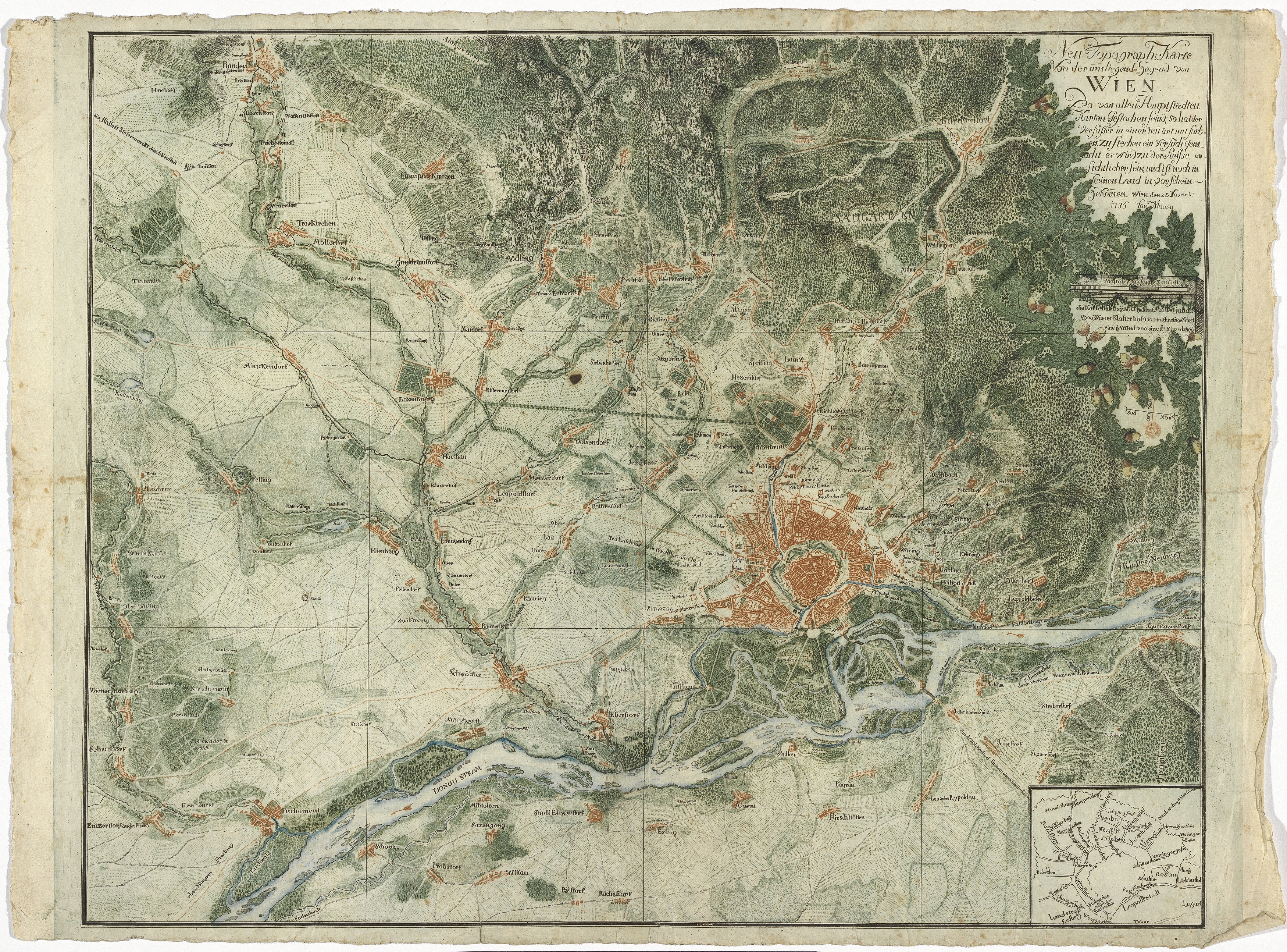
"Neue Topograph Karte Von der umliegend Gegend von Wien"
(Original title)- Title
- Topografische Karte der Umgebung von Wien
- Artists/Producer
Name Role Johann Georg Weingand (1712—1788) publishing houseattributed to: Joseph Daniel von Huber (1730—1788) cartographer- Inventory number
- 18270
- Classification
- Date
- 1786
- Material
- Technique
- Dimensions
- Maßstab: ca. 1:73.000
- Blattmaß 42,2×57 cm
- Bildmaß 40×50,3 cm
- Themes
- Subjects
- Iconclass Codes
- External Links
Have you found a possible mistake or have additional information about this object?
We look forward to hearing from you at:
onlinesammlung@wienmuseum.at